A live weather wallpaper for Mac sounds simple: put the weather on the desktop and let it update.
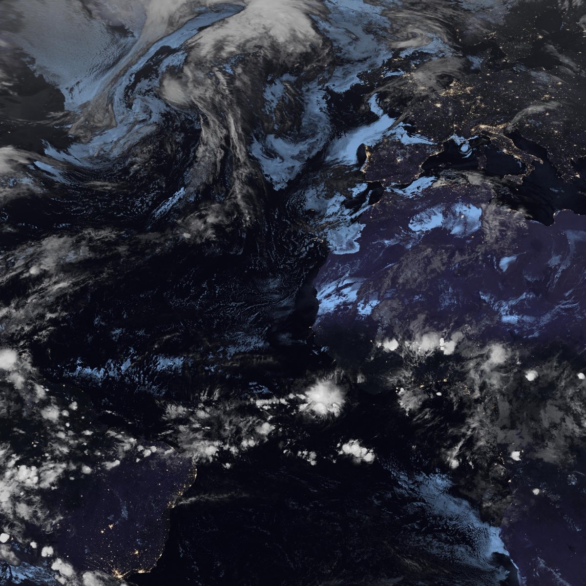
In practice, the best version is not a forecast widget stretched across the screen. A number, icon, or rain percentage can be useful, but it does not make the desktop feel alive. The richer approach is to use real satellite cloud imagery as the wallpaper layer, then let that image refresh as weather systems move.
That is the idea behind LiveAtlas. The app turns satellite cloud maps into a calm macOS wallpaper, with optional weather context and regional views for people who want the desktop to reflect the atmosphere outside the screen.
What makes a weather wallpaper feel live?
A wallpaper feels live when it changes for a real reason.
Looping video can look animated, but the weather in the image is not connected to the current atmosphere. A random wallpaper rotation can feel fresh, but it is still a set of finished pictures. A live weather wallpaper is different because the source image is tied to recent cloud patterns, daylight, regional weather systems, and large-scale atmospheric movement.
For a Mac desktop, that matters because the wallpaper is always present but rarely the main task. You do not want it to behave like a noisy dashboard. You want it to sit behind windows and still be useful when you glance at it.
Satellite cloud maps are a good fit for that role. They show weather at system scale without requiring dense labels or controls.
Why satellite cloud maps work better than icons
Forecast icons compress weather into symbols: sunny, cloudy, rainy, windy. Those symbols are efficient, but they hide the shape of the atmosphere.
A satellite cloud map shows that shape.
You can see a long cloud band approaching a coastline. You can see a typhoon eye over the ocean. You can see clear air behind a frontal system. You can see whether clouds around your region are isolated, organized, or part of something much larger.
This does not replace an official forecast or warning. It gives context to the forecast. A live weather wallpaper is most useful when it helps you understand why the weather feels the way it does.
Start wider than your exact location
One common mistake is choosing a wallpaper view that is too local.
If you crop a satellite image tightly around a city, two things can happen. First, the image may not have enough source detail to look good on a Retina display. Second, the weather loses context. You may see clouds above your area, but not the larger system that is creating or moving those clouds.
For most users, the better starting point is a wider region:
the coastline around your city
the ocean basin where storms approach from
the monsoon or frontal corridor that influences your area
the island chain or mountain region that shapes daily weather
This is why LiveAtlas focuses on regional Earth views as well as custom areas. A good live weather wallpaper should be personal enough to matter, but wide enough to explain what is happening.
A desktop wallpaper is not a weather dashboard
Weather dashboards are useful when you need details. They can show radar, hourly forecasts, severe weather warnings, charts, layers, and model output.
The desktop has a different job.
The best desktop information is quiet. It should be available without becoming another app you have to manage. A live satellite wallpaper can stay in the background while still showing clouds, daylight, storms, and broad regional patterns.
That is the difference between checking weather and living with weather context.
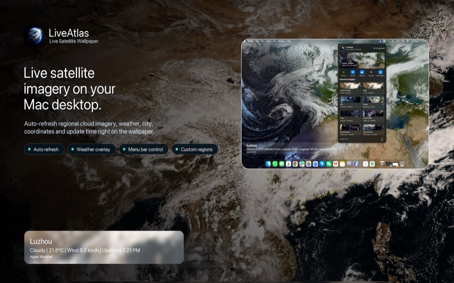
LiveAtlas is designed for the second case. It is meant to make the Mac desktop feel connected to Earth without turning the screen into a control panel.
When typhoon tracking belongs on the wallpaper
For tropical systems, a live satellite wallpaper can become especially interesting.
A typhoon is not just a point on a forecast map. Its structure matters: the eye, eyewall, spiral rainbands, outer cloud shield, and relationship to nearby islands or coastlines. Seeing that structure on the desktop can help weather enthusiasts follow the system visually throughout the day.
LiveAtlas supports typhoon information overlays, but the same safety boundary still applies: always rely on official meteorological agencies and local emergency authorities for warnings, travel, marine operations, and preparation decisions.
The wallpaper is visual context, not an emergency product.
Related topic:
https://www.liveatlas.top/topics/typhoon-satellite-tracker-wallpaper.html
Related article:
https://www.liveatlas.top/blog/typhoon-bavi-satellite-eye-liveatlas-2026
Why Himawari and regional satellite views matter
People often search for a single phrase such as Himawari satellite wallpaper, GOES satellite wallpaper, or satellite cloud map for Mac. Underneath those searches is a practical question: which satellite view is best for the region I care about?
Himawari imagery is strongly associated with the Asia-Pacific and western Pacific storm corridor. GOES imagery is important for the Americas. Meteosat is commonly associated with Europe, Africa, and adjacent oceans. GK-2A adds another valuable Asia-Pacific view.
The right live weather wallpaper depends on matching your region to a source that naturally covers it well.
Related topic:
https://www.liveatlas.top/topics/himawari-satellite-wallpaper.html
How LiveAtlas fits
LiveAtlas is a macOS app for people who want a real Earth view on the desktop. It uses public satellite imagery contexts, regional cloud maps, optional weather overlays, and scheduled wallpaper updates to make the desktop feel current.
It is useful for:
weather watchers who want broad cloud context
Mac users who want something more meaningful than a static wallpaper
space and geography fans who enjoy seeing Earth as a living system
people who want a calm desktop instead of another forecast dashboard
The app is independent from satellite operators and weather agencies. It does not claim ownership of public satellite data, and it does not replace official forecasts or warnings.
The practical takeaway
If you are searching for a live weather wallpaper for Mac, look for three things.
First, the wallpaper should be based on real or near real-time weather imagery, not only a decorative animation.
Second, it should let you choose a region wide enough to show the weather system around your location.
Third, it should stay quiet. A good wallpaper should make the desktop more connected to the planet, not more distracting.
That is the role LiveAtlas is trying to fill: a calm, real satellite cloud map for the Mac desktop, updated as the atmosphere changes.
Start with the topic guide:
https://www.liveatlas.top/topics/live-weather-wallpaper-mac.html