GK-2A Satellite: Korea’s Geostationary Weather Satellite Watching Asia-Pacific Clouds
When people search for weather satellite images of East Asia, they often find names like Himawari, GOES, Meteosat, and Fengyun. But another important satellite quietly plays a major role in monitoring clouds, storms, and atmospheric changes across the Asia-Pacific region: GK-2A.
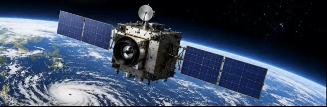
GK-2A, officially known as Geo-KOMPSAT-2A, is South Korea’s new-generation geostationary meteorological satellite. It is operated by the Korea Meteorological Administration and is designed to observe atmospheric phenomena over the Asia-Pacific region. Public data descriptions place GK-2A at 128.2°E, giving it a strong viewing position over Korea, East Asia, and the western Pacific.
For users interested in GK-2A satellite cloud images, real-time Asia weather satellite images, or a Korean geostationary weather satellite, GK-2A is one of the most useful data sources to understand.
What Is the GK-2A Satellite?
GK-2A is a geostationary weather satellite. That means it stays above roughly the same region of Earth as the planet rotates. This allows it to continuously observe the same wide area instead of passing over different locations like a low-Earth-orbit satellite.
The satellite was launched in December 2018, and Korea’s official GK-2A data service began in July 2019 after in-orbit testing.
Its main mission is operational meteorology: watching clouds, water vapor, storms, and other weather-related signals from space. The World Meteorological Organization lists Geo-KOMPSAT-2A as a satellite whose main mission is operational meteorology.
Why GK-2A Matters for Asia-Pacific Weather
The Asia-Pacific region is one of the most active weather regions on Earth. It includes monsoon systems, tropical cyclones, typhoons, heavy rainfall events, sea fog, dust, and rapidly changing cloud patterns.
Because GK-2A is geostationary, it can repeatedly observe these systems from the same viewing angle. This is especially valuable for:
* typhoon development and movement
* cloud-top temperature monitoring
* storm structure observation
* sea fog and low cloud detection
* rainfall system tracking
* East Asia and western Pacific weather analysis
This makes GK-2A highly relevant for searches such as Korean satellite for typhoon monitoring, Asia Pacific geostationary weather satellite, and GK2A weather satellite Asia Pacific.
The AMI Instrument: The Eye of GK-2A
The key imaging instrument onboard GK-2A is the Advanced Meteorological Imager, usually called AMI.
According to public GK-2A data descriptions, AMI observes with 4 visible channels and 12 infrared channels, for a total of 16 channels. It can scan the full Earth disk every 10 minutes and the Korean Peninsula region every 2 minutes.
This is important because different channels reveal different atmospheric features. Visible channels are useful for daytime cloud and surface imagery, while infrared channels can observe cloud-top temperatures and weather patterns even at night.
For anyone searching for Geo-KOMPSAT-2A AMI instrument or GK2A satellite full disk images, AMI is the core technology behind the satellite’s weather imagery.
What Can You See in GK-2A Images?
GK-2A satellite imagery can show much more than simple cloud cover. Depending on the channel or product, users may see:
* large cloud systems over East Asia
* tropical cyclones and typhoon structure
* water vapor patterns in the atmosphere
* convective storm development
* dust or aerosol movement
* day-night cloud changes
* full-disk views of Earth from East Asia
This makes GK-2A valuable not only for meteorologists, but also for weather enthusiasts, educators, developers, and anyone interested in Earth observation.
GK-2A vs Himawari: A Useful Comparison
Many users searching for East Asia weather imagery are already familiar with Japan’s Himawari satellites. GK-2A and Himawari serve similar regional observation purposes, but they are operated by different countries and have different viewing positions.
A simple way to understand the difference:
Himawari is often the best-known satellite source for Japan, Australia-facing western Pacific views, and broad Asia-Pacific weather imagery.
GK-2A is Korea’s geostationary weather satellite, with a viewing position especially useful for Korea, East Asia, and the western Pacific.
For developers, educators, and satellite imagery users, comparing GK-2A vs Himawari satellite imagery can be useful because each satellite may offer a slightly different visual angle, regional emphasis, and data access path.
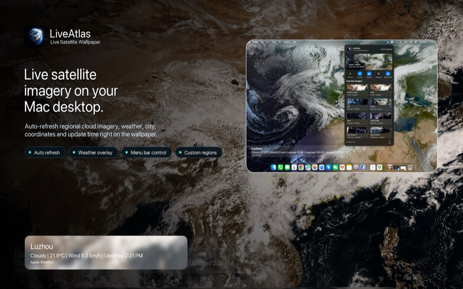
Why GK-2A Is Interesting for Weather Apps and Visual Earth Tools
GK-2A is not only useful for professional forecasting. It is also interesting for visual applications that want to show real Earth imagery.
For example, a macOS app like LiveAtlas can benefit from global and regional satellite imagery concepts because users increasingly want desktop experiences connected to real-world Earth observation. While LiveAtlas focuses on turning satellite imagery into a beautiful desktop experience, satellites like GK-2A show why regional weather observation matters: every part of Earth has its own cloud behavior, storm patterns, and atmosphere.
For users who enjoy satellite-based visuals, GK-2A adds another layer of understanding to how modern weather imagery is created.
Final Thoughts
GK-2A is an important but often overlooked satellite for Asia-Pacific weather observation.
As South Korea’s Geo-KOMPSAT-2A satellite, it provides continuous geostationary monitoring of clouds, storms, typhoons, and atmospheric changes across East Asia and the western Pacific. Its AMI instrument, 16 observation channels, and frequent scanning capability make it a valuable source for modern weather monitoring.
For anyone searching for GK-2A satellite explained, GK2A weather satellite Asia Pacific, or real-time Asia weather satellite images, GK-2A is a satellite worth knowing.